❌

Normal view

Has there ever been a mountain taller than Everest?

17 October 2026 at 10:00

Sometimes, it takes a great struggle to build towering peaks. And what more thunderous event is there than the clashing of continental plates?

Geological pileups have birthed some of the largest and tallest mountains on the planet, including Mount Everest and its Himalayan neighbors. But has there ever been a peak taller than Mount Everest, which stands 29,032 feet (8,849 meters) above sea level?

The answer is still a mystery, but there are some geological clues about where the tallest peaks would have been in the ancient past, experts told Live Science.

Earth's lost mountains

Geologists don't have the level of detail required to pinpoint an exact highest peak hundreds of millions of years ago. "We're never going to get that granularity, unfortunately," Alan Collins, a professor of geology at Adelaide University in Australia, told Live Science.

However, clues in residual sediments lodged inside Earth's crust hint at the lost grandeur of primordial snowcaps and summits. Scientists study these crusts to understand how deep they went, which can reveal how tall ancient mountains might have been.

Mountains are really just parts of the continental crust that have been thrust upward as tectonic plates slowly crash together. This crust is very heavy, and there is much more to it than what you see on the surface; even the most spectacularly tall peaks, like Everest, are anchored in deep crust. Just as crust gets thrust up to form mountain peaks, it also gets pushed deep under the surface. Both Collins and Ziyi Zhu, a geochemist at Curtin University in Australia, compared mountains to icebergs, in the sense that only a bit pokes above the surface.

"We can argue or speculate that [the biggest mountain] was in a place where there were deep roots in the crust," Zhu told Live Science.

Geologists estimate that the Himalayas, for example, have a crustal column that goes down as far as 50 miles (80 kilometers). Compare that to Everest's elevation of about 29,000 feet (9,000 m), and the world's tallest mountain at most represents only 14% of the rock slab it's part of. That means there's a limit to how tall mountains can get before they collapse under their own weight.

The Himalayas began forming between 50 million and 40 million years ago from the collision between the Indian Eurasian continental plates. As far as mountains go, they are relatively young. And that's partly why they are still so tall. Tall, jagged mountains erode quickly over time, though the Himalayas are still growing as the two plates continue to collide.

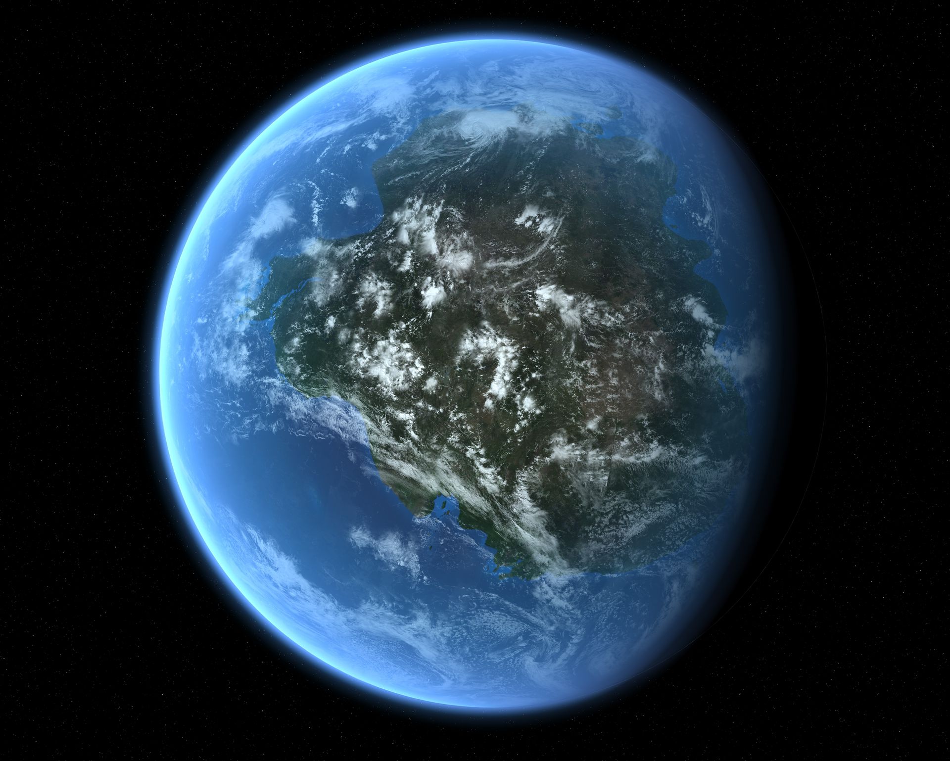
Such continental collisions have happened countless times before, though. For example, the Transgondwanan Supermountain, an ancient range in what is now East Africa, began emerging some 650 million years ago when Africa and South America crashed into Arabia, India, Australia and Antarctica to form the supercontinent Gondwana.

illustration showing the supercontinent of Gondwana

The ancient supercontinent of Gondwana. (Image credit: Mark Garlick/Science Photo Library/Getty Images)

Gondwana split up again, but evidence of these mountains in places like southern India, Sri Lanka, Tanzania and Kenya point to them being three times the length of the Himalayas. "If you walk around there now, you can see rocks that were at the bottom of this mountain belt," Collins told Live Science. On average, the crust is deeper than the crust of the Himalayas. "We think this is at least the scale of the Himalayas if not more," Collins said.

The crusts found in these areas also hint at how tall the mountains were, with sections that descend up to 18 miles (30 km) deep, despite half a billion years of erosion. "At some point, they were likely halfway down a crustal column that was 60 kilometers [37 miles deep]," Collins said. This means that the mountains above this base could have been as tall as Everest.

In the Himalayas, the tallest mountains sit around the rim of the Tibetan Plateau, which has the highest elevation on the planet, at about 3.7 miles (6 km) above sea level, on average. The Transgondwanan range may have had a similar plateau around southern Madagascar, meaning its rim would have been in eastern Madagascar, southern India and eastern Antarctica, Collins said.

Another candidate for the tallest mountains was the Grenville orogeny, which popped up with the formation of the supercontinent Rodinia starting about 1.3 billion years ago. Its remains can be seen around southeastern Ontario and northwestern Vermont. But less is known about this extinct range, Collins said, with some scholars arguing that it wouldn't have been as tall as the Transgondwanan range or the Himalayas.

Further back, some 2 billion years ago, the formation of the supercontinent Nuna (also called Columbia) also left evidence of truly giant mountains. Zhu's paper found evidence of this supermountain by examining the composition of zircon crystals left in the crust underneath this vanished range.

Look any further back, however, and the picture gets murkier. When Earth was hotter, mountains likely couldn't get as high because warmer crusts can support less weight, Collins said. Stable continental plates and rocks didn't start to form until about 4 billion years ago, and it took hundreds of millions of additional years for large continents to form.

For Zhu, the Nuna, Transgondwana and Himalaya ranges are currently the best candidates for holding the tallest mountains that ever existed. But it's likely impossible to pinpoint the highest specific peak, at least with current scientific methods. "It's an open question," Zhu said.

How much do you know about our blue planet? Test your terran knowledge with our Earth quiz!

One of America's biggest meteor craters is 100 million years younger than we thought β€” and coincided with a global extinction event

14 October 2026 at 14:08

One of America's largest meteor craters is around 100 million years younger than scientists thought, which means the ancient impact coincided with β€” and potentially contributed to β€” one of the biggest global extinction events in Earth's history, according to a new study.

The underground impact structure, known as Ames crater, is located in northern Oklahoma and is named after a small town that sits above the submerged crater. At around 10 miles (16 kilometers) wide, it is the fourth-largest impact structure in the U.S.

Ames crater was created when an Eiffel Tower-size space rock slammed into our planet at more than 70,000 mph (110,000 km/h). At the time, the region was covered in a shallow ocean, and the crater was subsequently buried beneath layers of seafloor sediment. Therefore, there are no visible signs of the crater at the surface today. It was only discovered in 1991, when oil prospectors accidentally drilled into it.

Until now, researchers thought Ames crater dated to the Ordovician meteor event around 467 million years ago. During this period, an unusually high number of large space rocks smashed into Earth, likely due to the fragmentation of a single parent body somewhere in space. Scientists found fossils of marine animals in and around the crater that date to around the time of that event.

But in the new study, published July 7 in the journal Meteoritics and Planetary Science, researchers analyzed fracture patterns within tiny rocky fragments known as zircon crystals that were embedded in the underground crater. This revealed that the impact actually occurred 370 million years ago, around 97 million years after the Ordovician meteor event.

A satellite photo of the Oklahoma countryside with a large orange circle highlighting the location of the buried Ames crater

There are no visible signs of the Ames crater today. However, scientists have been able to map out its size and shape using ground-penetrating radar. This circle represents the rough outline of the the submerged structure. (Image credit: EarthExplorer/USGS/Landsat with annotations Harry Baker)

"No matter what technique we used, it was coming back to this younger signal," study first author Elizabeth Catlos, a geologist and planetary scientist at the University of Texas at Austin, said in a statement.

Reading crystals

Zircon crystals are tiny pieces of a superdurable mineral known as zirconium silicate. These crystals are scattered throughout most of Earth's rock formations, including most of the oldest known rocks on our planet. The near-industructible crystals are extremely useful to geologists because their internal structure preserves evidence of being exposed to extreme conditions, such as high temperatures and intense pressures.

Analyzing zircon crystals is now one of the primary methods of dating ancient meteor craters, and the technique has led to several other impact dates being revised. For example, in July, researchers in Australia revealed that the North Pole Dome crater was around 500 million years younger than initial studies predicted, and in 2025, experts found that the impact that birthed Scotland's Stac Fada Member structure happened around 200 million years later than earlier research estimated.

The crystals offer insight into what Earth may have looked like shortly after it formed and have recently been used to more accurately date the moon.

A microscope image of a zircon crystal

The internal structure of zircon crystals preserves evidence of being exposed to extreme conditions, such as high temperature and pressure, making them ideal for exploring ancient impacts. This photo, captured during a completely unrelated study, shows one such crystal under an electron microscope. (Image credit: Emmanuel Roquette via Wikimedia)

"These small crystals allow us to go back in time and learn about the major changes to Earth's ancient landscapes," study co-author Danny Stockli, a geologist and dean of the Jackson School of Geosciences at the University of Texas at Austin, said in the statement. "It would be great to do this for more of the meteor impact sites across the continent so we could get a more accurate timeline for these major events."

"This is where the impact belongs"

The crater's new age takes it firmly out of the Ordovician meteor event and places it into the Frasnian-Famennian mass extinction event, also known as the Kellwasser event or the Late Devonian mass extinction.

During the Frasnian-Famennian event, which began around 372 million years ago and lasted for several million years, as much as half of all marine life went extinct as Earth's oceans were depleted of oxygen. The die-off, which was most likely triggered by global cooling due to increased levels of volcanic activity, is often cited as one of the five major extinction events in Earth's history.

The researchers emphasized that the Ames impact was not the cause of the Frasnian-Famennian event. However, they noted that the fallout from the impact, which would have injected huge clouds of dust into the air, may have contributed to the atmospheric cooling effect in the region.

It is an important reminder that the ability to accurately date specific events like this can inform our understanding of wider global patterns and trends, the researchers wrote.

"With this research, we're basically taking a major pawn out of the Ordovician Meteor Event and dumping it into the Frasnian-Famennian event, and saying, 'This is where this impact belongs,'" Catlos said.

The new study was dedicated to co-authors Andrew Parisi and Michael Brookfield, who sadly died before it was published.

What's been driving Hawaii's lava fountains?

9 October 2026 at 22:05

In most cases, hotspot-driven volcanism is relatively sedate, with lava flowing down mountainsides slowly enough that people can walk out of its way. But in a number of locationsβ€”Mount Etna, Hawaii, Icelandβ€”lava gets expelled in dramatic fountains that can reach several hundred meters in height.

Right now, we're not sure what powers them. However, thanks to a recent set of eruptions at the Kilauea volcano, we have some of the best documentation yet of erupting lava fountains. In a recent edition of Science, researchers from the US Geological Survey describe what we've seen and compare it with what we might expect based on our best ideas about what powers these fountains of molten rock.

Years of fountains

With three active volcanic regions that engage in fountaining, there has been a steady flow of dramatic videos of red-hot molten rock spouting from the Earth. But Kilauea has had only three fountaining episodes since 1823, even though it's the youngest and most active volcano in Hawaii. That activity has led to intensive study, and we have a good idea of the volcano's structure. Previous work has identified a couple of lava residues within a few kilometers of the surface, and the volcano had 35 separate data-gathering stations set up on Kilauea, including "seismic, infrasound, geodetic, gas, and visual and thermal cameras."

Read full article

Comments

Β© Mike Lyvers

❌